The CLU Boundary API provides access to the full 2008 Common Land Unit (CLU) boundary dataset - the last publicly available CLU distribution - for a given area of interest.
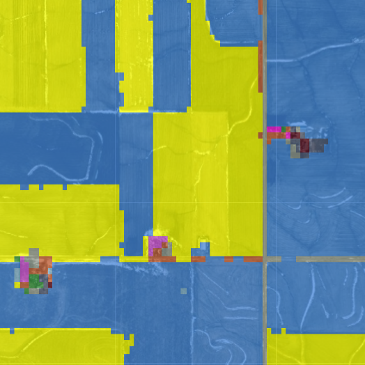
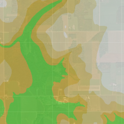
The USDA Cropland Data Layer (CDL) is a geo-referenced, crop-specific land cover map for the continental United States, built annually using satellite imagery and agricultural ground truth. The Cropland Data Layer API easily delivers CDL results for a given year and area of interest.
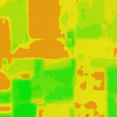
The SSURGO Soils API provides soil type data and soil attribute averages (e.g., NCCPI) by field for a given area of interest, sourced from the USGS Soil Survey Geographic Database (SSURGO) Soils dataset. SSURGO V2 handles both raster and GeoJSON AOI/file requests.
The POLARIS Soils API offers a means to clip the POLARIS dataset to a user-provided area of interest. POLARIS provides a quantitative prediction of soil attributes (including pH, clay %, organic matter %) at different depths across the contiguous United States.
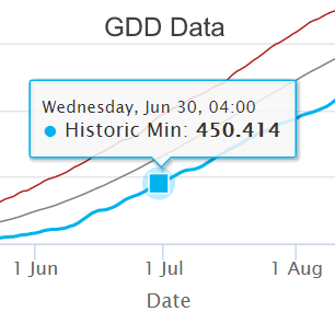
The PRISM GDD API delivers cumulative, historic, and yearly growing degree day data for a given area of interest and temperature threshold, sourced from the PRISM Climate Group.
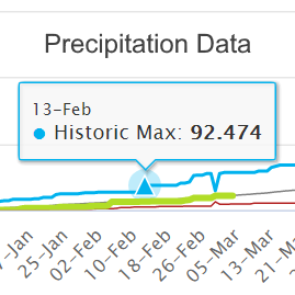
The PRISM Precipitation API provides historic and yearly accumulated precipitation to date for a given location, sourced from the PRISM Climate Group.
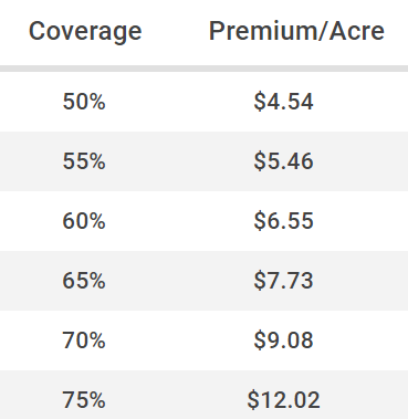
The Federal Crop Insurance API calculates location-based insurance premiums for Yield Protection, Revenue Protection, and Revenue Protection with Harvest Price exclusion.
The Harmonized Landsat Sentinel (HLS) API allows users to request synergized or stand-alone imagery from the Landsat-8 and Sentinel-2 satellites. This service provides advanced cloud cover filtering and interpolation options to improve the existing imagery. Indices such as NDVI as well as bands such as NIR are available through the service.
The Digital Elevation Model (DEM) API allows for clipping boundaries to the 10 meter USGS DEM map of the United States.
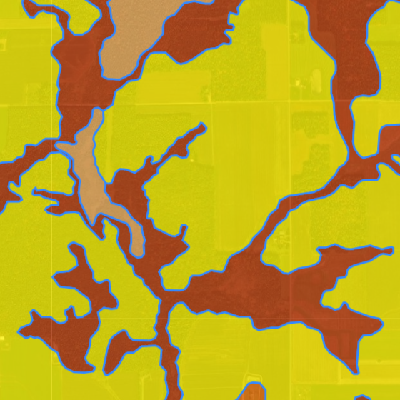
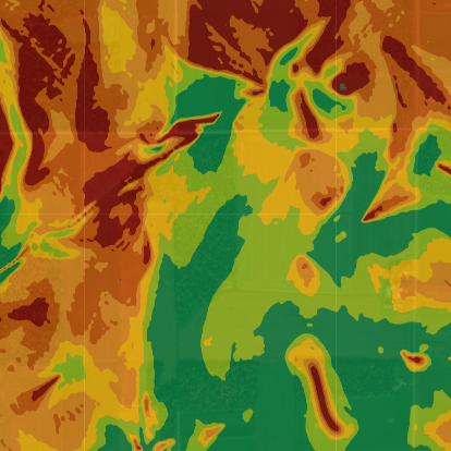
The Elevation Index API computes four elevation indices for a given AOI to provide advanced topographical insights. Indices include slope, topographical position index, terrain ruggedness index, and relative elevation.
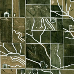
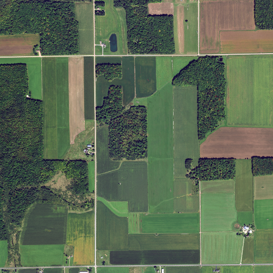
The National Agriculture Imagery Program (NAIP) collects aerial imagery during the agricultural growing season. The NAIP API provides easy access to imagery from NAIP for provided areas of interest.
The Ag-Analytics® CropAI crop identification API uses Harmonized Landsat-Sentinel bands, soil stats, crop rotation data, prices, and machine learning to determine what crop has been planted on a given field and when.
The Ag-Analytics® TillageAI API predicts whether or not a provided field has been tilled. The underlying Tillage Model has trained on millions of acres of ground-truth precision data coupled with SAR data, Harmonized Landsat-Sentinel multispectral satellite data, and other data streams.
The Ag-Analytics® Yield Forecast API uses Artificial Intelligence algorithms to forecast the yield on a given field, based on geospatial data.
The Ag-Analytics® Yield Forecast API uses Artificial Intelligence algorithms to forecast the yield on a given field, based on geospatial data.
Pricing
| Plans | Free/Trial | Academic | Analyst & Startup | Government | Professional |
|---|---|---|---|---|---|
| SSURGO Soil | $0/month | $0/month | $20/month | $50/month | $100/month |
| Calls Per Minute/Month | 4/50 | 10/1000 | 20/2000 | 100/10000 | 100/10000 |
| Download Limit Per Month | 25mb | 500mb | 2gb | 10gb | 10gb |
| Cropland Data Layers | $0/month | $0/month | $20/month | $50/month | $100/month |
| Calls Per Minute/Month | 4/50 | 10/1000 | 20/2000 | 100/10000 | 100/10000 |
| Download Limit Per Month | 25mb | 500mb | 2gb | 10gb | 10gb |
| 2008 CLU Boundaries | $0/month | $0/month | $100/month | $250/month | $350/month |
| Calls Per Minute/Month | 4/50 | 50/1000 | 50/1000 | 200/10000 | 200/10000 |
| Download Limit Per Month | 25mb | 500mb | 500mb | 2gb | 2gb |
| POLARIS Soil | $0/month | $0/month | $20/month | $60/month | $120/month |
| Calls Per Minute/Month | 4/50 | 10/1000 | 20/2000 | 100/10000 | 100/10000 |
| Download Limit Per Month | 25mb | 500mb | 2gb | 10gb | 10gb |
| Federal Crop Insurance Quoter | $0/month | $0/month | $50/month | $100/month | $200/month |
| Calls Per Minute/Month | 4/50 | 10/1000 | 15/2000 | 50/5000 | 50/5000 |
| Download Limit Per Month | 25mb | 500mb | 2gb | 10gb | 10gb |
| PRISM GDD | $0/month | $0/month | $10/month | $50/month | $100/month |
| Calls Per Minute/Month | 4/50 | 10/1000 | 20/2000 | 100/10000 | 500/10000 |
| Download Limit Per Month | 25mb | 5gb | 10gb | 20gb | 20gb |
| Precipitation | $0/month | $0/month | $20/month | $50/month | $100/month |
| Calls Per Minute/Month | 4/50 | 10/1000 | 20/2000 | 100/10000 | 500/10000 |
| Download Limit Per Month | 25mb | 5gb | 10gb | 20gb | 20gb |
| Farmland Sales | $0/month | $0/month | $800/month | $1500/month | $2000/month |
| Calls Per Minute/Month | 1/4 | 1/4 | 25/200 | 500/10000 | 500/10000 |
| Download Limit Per Month | 5mb | 5mb | 2gb | 10gb | 10gb |
| Package Deal | $0 | $0 | $1500/month | $2000/month | $4000/month |
| Use Cases | |||||
| Government Use | ✖ | ✖ | ✖ | ✔ | ✔ |
| Commercial Use | ✖ | ✖ | ✔ | ✖ | ✔ |
| Web Application Use | ✖ | ✖ | ✖ | ✔ | ✔ |
Copyright Ag-Analytics® 2021